


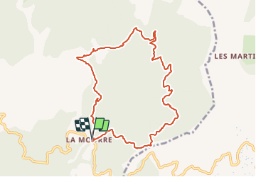

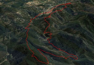
12,5 km | 19,3 km-effort


Benutzer


Kostenlosegpshiking-Anwendung
 SityTrail
IGN / Geografische Institute
SityTrail World
Die Welt öffnet sich für Sie
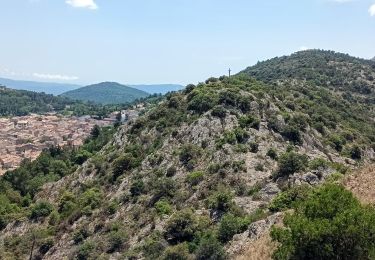
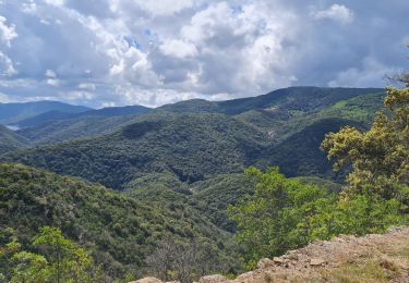
Tour Wandern von 10,4 km verfügbar auf Provence-Alpes-Côte d'Azur, Var, La Garde-Freinet. Diese Tour wird von boulinevelyne vorgeschlagen.
Une boucle facile décrite dans les brochures éditées par l'office du tourisme de la Garde Freinet. Voir :[url]http://les-randos-du-grand.eklablog.com/la-mourre-les-cabrettes-a213358593[/url]
Wandern

Wandern


sport
Wandern
Wandern
Zu Fuß
Rennrad
Wandern
Wandern